Remove 2010 Remove 2016 Remove 2017 Remove Public Sector
article thumbnail

34 new or updated datasets on the Registry of Open Data: New data for land use, Alzheimer’s Disease, and more

AWS Public Sector Blog

10m Annual Land Use Land Cover (9-class) is a global map of land use/land cover (LULC) derived from the European Space Agency’s (ESA) Sentinel-2 satellite imagery at 10m resolution for the years 2017-2021. Climate and weather: A Global Drought and Flood Catalogue from 1950 to 2016 from National University of Singapore.

article thumbnail

Building resilience: Using technology to prepare for, respond to, and recover from the unexpected

AWS Public Sector Blog

“I saw first-hand how communities are impacted by these types of events while living in Haiti in 2010,” shared Andrés Meira, founder and chief executive officer (CEO) of Grillo. Looking ahead: Holistic disaster response for the public sector. At the time, some 300,000 people were injured , and 1.5

article thumbnail

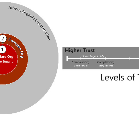
Microsoft Collaboration Framework for the US Defense Industrial Base

Microsoft Public Sector

Microsoft 365 (M365) was released as a public hyperscale cloud collaboration suite of products in 2010, including hosted services such as Exchange Online, SharePoint Online and has evolved to include Teams, Planner and many more. For example, in late 2017, Hurricane Harvey wreaked havoc across Texas.