Remove 2010 Remove 2017 Remove 2021 Remove Blog
article thumbnail

34 new or updated datasets on the Registry of Open Data: New data for land use, Alzheimer’s Disease, and more

AWS Public Sector Blog

10m Annual Land Use Land Cover (9-class) is a global map of land use/land cover (LULC) derived from the European Space Agency’s (ESA) Sentinel-2 satellite imagery at 10m resolution for the years 2017-2021. European Space Agency WorldCover 2021 & 2020 maps managed by Vito. 10m Annual Land Use Land Cover (9-class).

article thumbnail

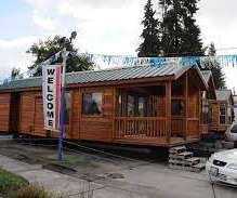
CED and Affordable Housing: How Does Manufactured Housing Fit In?

Community and Economic Development Program of UNC

in 2021 is $124,400 (average of single and double-wide, not including land). The School of Government has a variety of related blog posts. Manufactured homes are a statewide feature of North Carolina – we have more than almost any other state.

Housing 81
article thumbnail

Building resilience: Using technology to prepare for, respond to, and recover from the unexpected

AWS Public Sector Blog

I saw first-hand how communities are impacted by these types of events while living in Haiti in 2010,” shared Andrés Meira, founder and chief executive officer (CEO) of Grillo. In 2021, when fire erupted in the data center in the Province of Chubut in Argentina, authorities identified a critical need to migrate local government data.